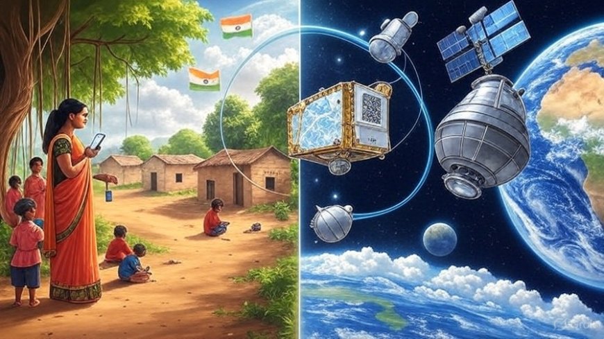
From Village Fields to Orbit: India-US NISAR Launch Mirrors Digital Dreams of Rural India
In a historic collaboration, India and the U.S. launched the NISAR satellite to track Earth's changes. But 2,000 km away, a small Indian village tells its own digital story—one that began long before UPI became mainstream.

Introduction: A Dual Triumph—In Space and on Soil
As ISRO and NASA successfully launched the NISAR (NASA-ISRO Synthetic Aperture Radar) satellite in a monumental joint space mission, the world turned its gaze skyward. The dual-frequency radar satellite promises to reshape how humanity understands natural disasters, ice melt, and Earth’s crustal shifts. But in the quiet village of Belwa, tucked away in eastern Uttar Pradesh, another story has been unfolding—one grounded not in orbital data, but in digital transformation. Here, long before UPI became a national force, farmers, traders, and schoolchildren were already embracing cashless payments.
This is a story of two breakthroughs—one above Earth’s atmosphere and the other within its grassroots.
NISAR: A Space Collaboration with Global Consequences
The NISAR satellite, the first radar imaging satellite to use two different frequencies (L-band and S-band), has been jointly developed by NASA and ISRO. Launched from the Satish Dhawan Space Centre in Sriharikota, NISAR is designed to monitor Earth’s natural hazards and ecosystem disturbances.
Key objectives include:
-
Measuring glacier and ice melt in polar regions.
-
Monitoring land deformation from earthquakes and landslides.
-
Tracking forest biomass, helping understand carbon storage.
The mission is not just scientific—it’s geopolitical. With NISAR, India and the U.S. deepen their strategic technology partnership, especially amid growing global focus on climate resilience, disaster management, and Earth sciences.
Technological Firsts of NISAR
This satellite stands out for multiple reasons:
-
Dual-band Synthetic Aperture Radar: Unlike previous Earth observation satellites, NISAR uses both L-band and S-band frequencies, allowing it to penetrate different surface types and provide high-resolution data.
-
24/7 Observation: NISAR can scan every part of Earth every 12 days, ensuring a continuous, reliable data stream.
-
Carbon Monitoring: It offers key inputs for climate change scientists studying carbon cycling in forested areas.
-
Publicly Available Data: Both NASA and ISRO have pledged open access to NISAR data, democratizing information for researchers and governments alike.
The Belwa Connection: Digital Transformation in a Remote Village
While NISAR takes flight in Earth’s orbit, Belwa—a village of roughly 3,500 people—has already completed its own kind of transformation. Back in 2017, when the country was still grappling with demonetisation’s aftershocks, Belwa’s sarpanch, Meera Tiwari, initiated a digital literacy campaign.
"We didn’t wait for UPI to reach us,” said Meera. “We built our own ecosystem through WhatsApp, Bluetooth file sharing, and local vendors with QR codes.”
Rural Pioneers of the Digital Age
Belwa’s journey wasn’t government-mandated—it was community-led. Supported by a nearby community college and a group of returnee migrants from Mumbai and Delhi, the village trained women shopkeepers, farmers, and students on:
-
QR Code Payments
-
Secure Mobile Wallet Usage
-
Voice-assisted Transactions for the elderly
-
Basic Cybersecurity Training
Today, the village boasts over 92% adoption of digital payments—a figure that surpasses many urban wards.
Drawing Parallels: Data from Space, Data from Soil
The NISAR satellite’s goal to capture minute movements on Earth finds an unlikely philosophical twin in Belwa’s digitised economy—both driven by data.
-
Monitoring Land: NISAR helps monitor subsidence and changes in land. In Belwa, GPS-based apps are used for land demarcation and irrigation planning.
-
Climate Impact Tracking: While NISAR measures glacier melt, Belwa uses remote sensor devices to monitor water levels in wells, allowing proactive drought planning.
-
Crisis Response: The same logic that guides satellite-based disaster readiness now underpins Belwa’s crop insurance claims via satellite mapping tools shared by local agri-tech startups.
Global Collaboration Meets Local Innovation
At a time when world powers seek alignment on technological advancement, the NISAR project shows what’s possible through collaborative diplomacy. Similarly, rural India shows what’s possible through collective community action.
The shared ethic of openness and accessibility unites both missions:
-
NISAR’s open data policy parallels Belwa’s free training sessions in its primary school yard.
-
NASA’s and ISRO’s transparent updates mimic the monthly village audits on digital usage.
-
Satellite-driven modeling in policy resonates with Belwa’s use of simple digital dashboards to track daily spending trends.
Policy Echoes: India’s Digital Future Aligned with NISAR’s Mission
The Government of India’s push for Digital India, BharatNet, and climate resilience meshes well with what both Belwa and NISAR represent. The satellite launch supports:
-
Agri-tech development by enabling crop yield forecasting and flood pattern detection.
-
Smart cities and villages, offering actionable land-use data and risk forecasting.
-
Citizen empowerment, through accurate and publicly available satellite images for land and property records.
Voices from the Ground: A Dialogue Between the Sky and the Soil
We spoke with Satyam Verma, a 21-year-old data science undergraduate from Belwa, who interned with a climate-tech startup using satellite data. “I used to think satellites were only for military or weather updates. But when I saw NISAR’s payload and mission, I realised how it connects to our lives—how it can help farmers, planners, even grocers."
Lalita Devi, a 52-year-old tailor who now accepts digital payments for every blouse she stitches, smiled when shown a poster of the satellite. “They’re watching from the sky, and we’re rising from the ground. That’s India’s story, no?”
Conclusion: A Tale of Two Orbits—One Global, One Local
The launch of NISAR marks a significant step in India’s space journey, symbolising cutting-edge collaboration and deep scientific goals. But perhaps its most meaningful connection lies not just in the clouds or the crust, but in stories like Belwa’s—where data, resilience, and community meet.
In the countdown to India’s 100th year of independence in 2047, both efforts will matter: satellites capturing Earth’s shifts and villages shaping India’s digital shift. Together, they represent a convergence of technology, sovereignty, and people power.


